Sunday
12/6/25 at 20:33
Pearl Harbor Rememberance Day
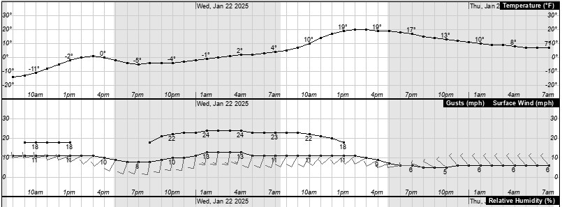
Temperature
Humidity
Barometer
Wind
20.9°F
(FEELS LIKE) 20.9°F
81%
(-4% 24hr change)
29.03
(0.28" 24hr change)
0.0 - SSE
Wind Gust(26.0 mph)
Temperature Chart
Dew Point-Humidity Chart
Precipitation Chart
Solar Radiation


Wind Chill
RH and Dew Point
Miscellaneous
Almanac
Current Wind Chill
20.9°F
Low Wind Chill-Today
4.3°F
Low Wind Chill Time
9:16
Heat Index
25.3°F
Low RH Today
71 %
Low RH Time Today
4:47
Low RH Yesterday
58 %
Current Dew Point
16.0 °F
Solar Radiation
0
Evapotranspiration
0.01"
Structure
67.0°F
Low Dewpoint Today
9.4 °F
Sunrise
7:20
Sunset
16:18
Moon Rise
17:55
Moon Day
#17
Daily Rainfall
Monthly Rainfall
Yearly Rainfall
24 Hour Rainfall
Since midnight
0.00"
Total
0.00"
Total
21.52"
24 Hour Rainfall
Or Snow Melt
0.00"
Waupaca Fire Danger
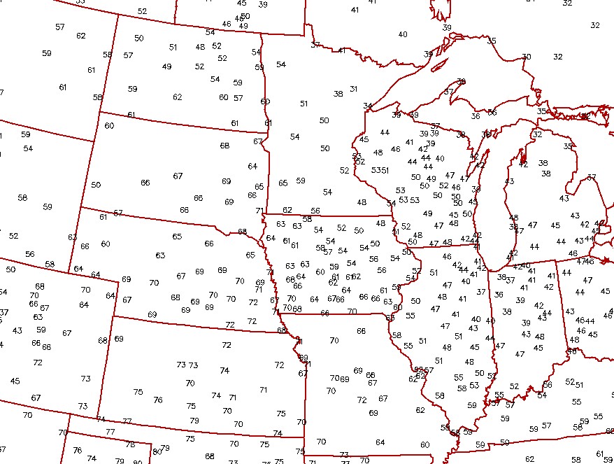
Surface Temps
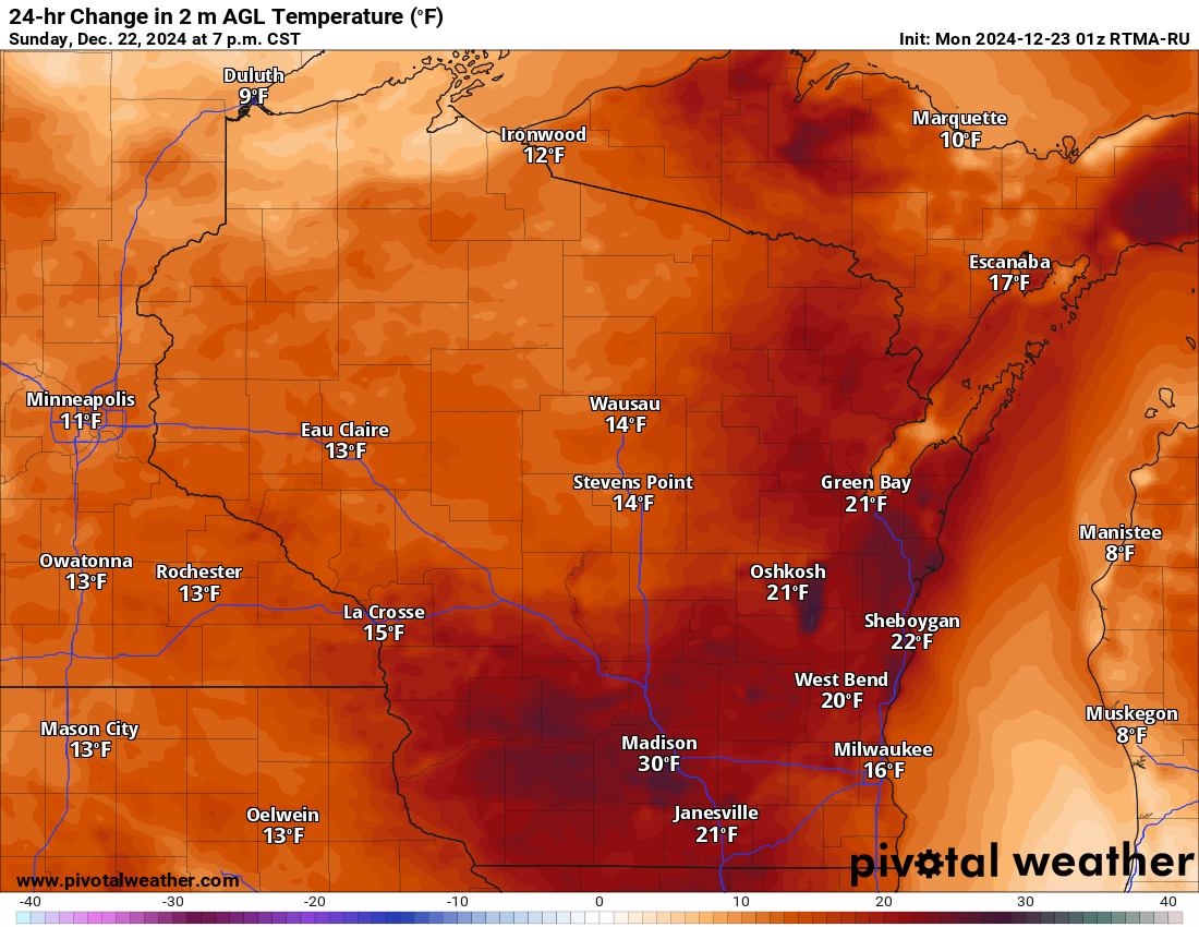
24-Hr Temp Change
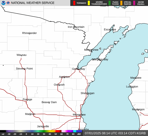
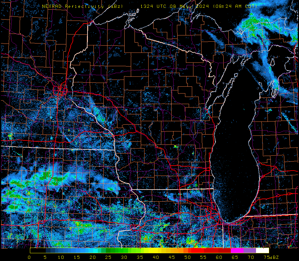
Saint Cloud Radar
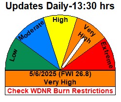
Link-WDNR Burn Restrictions
click to enlarge
click to enlarge

click to enlarge
Aviation Wx Center
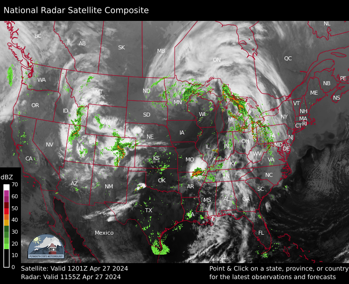
Midwest Radar
Wisconsin Radar
Lightning Map
click to enlarge

click to enlarge
click to enlarge

click to enlarge
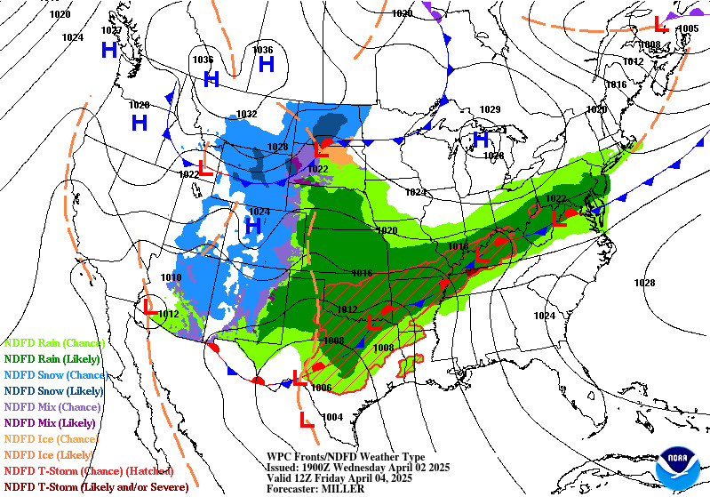
Day 1 Weather Map
Day 2 Weather Map
SPC Day 1 Tornado Outlook
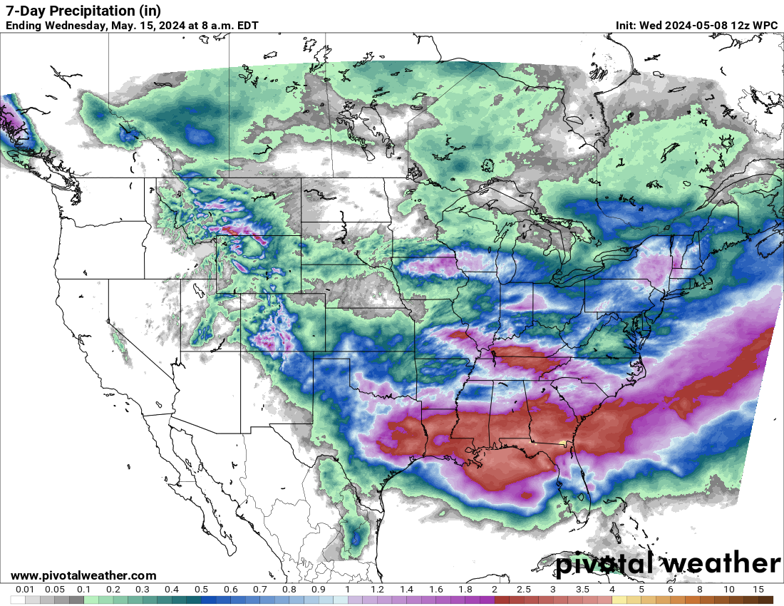
7-Day Precipitation (in)

click to enlarge
click to enlarge

click to enlarge
click to enlarge
GOES 16 Visible
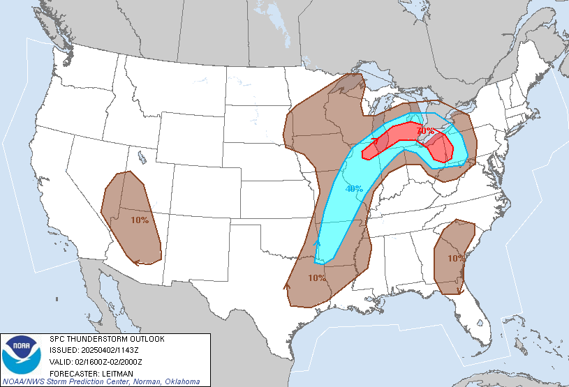
SPC Day 2 Thunderstorms
SPC Day 1 Outlook
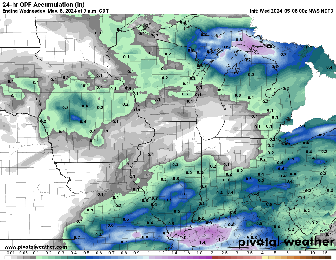
24 Hr QPF Regional
click to enlarge
click to enlarge

click to enlarge
click to enlarge
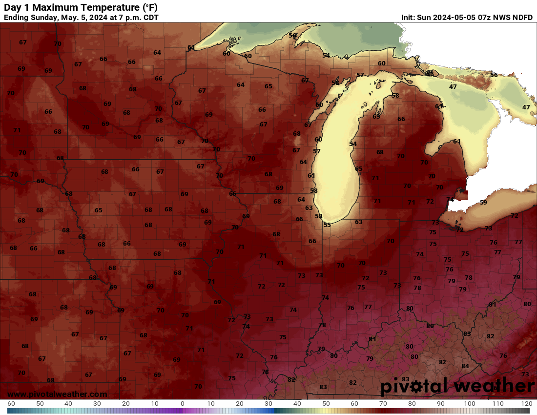
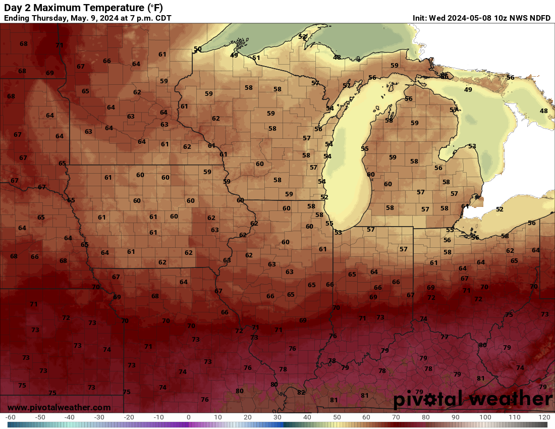
Day 1 Max Temps
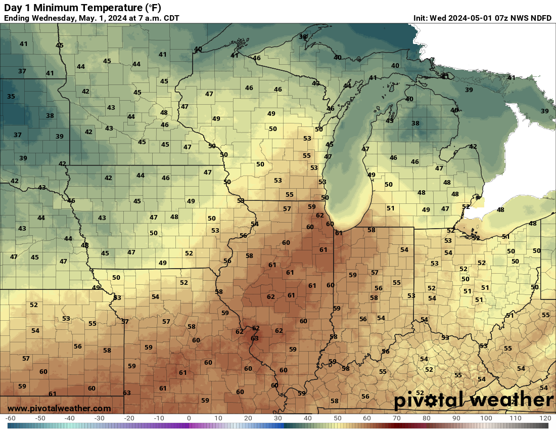
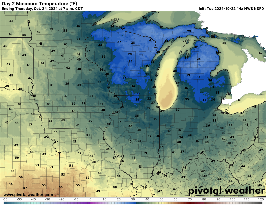
Day 1 Min Temps
Day 2 Max Temps
Day 2 Min Temps
click to enlarge
click to enlarge
click to enlarge
click to enlarge
Fire Wx Outlook
T-Storm Outlook
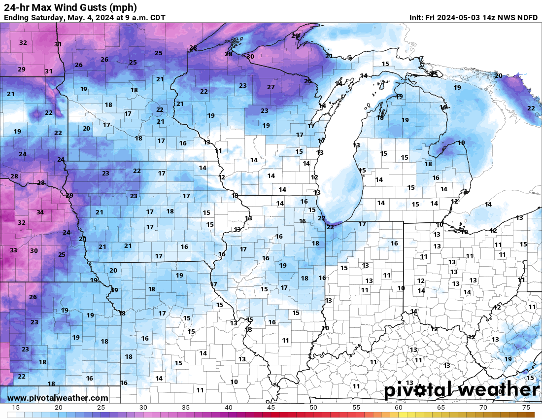
24 hr Max Winds
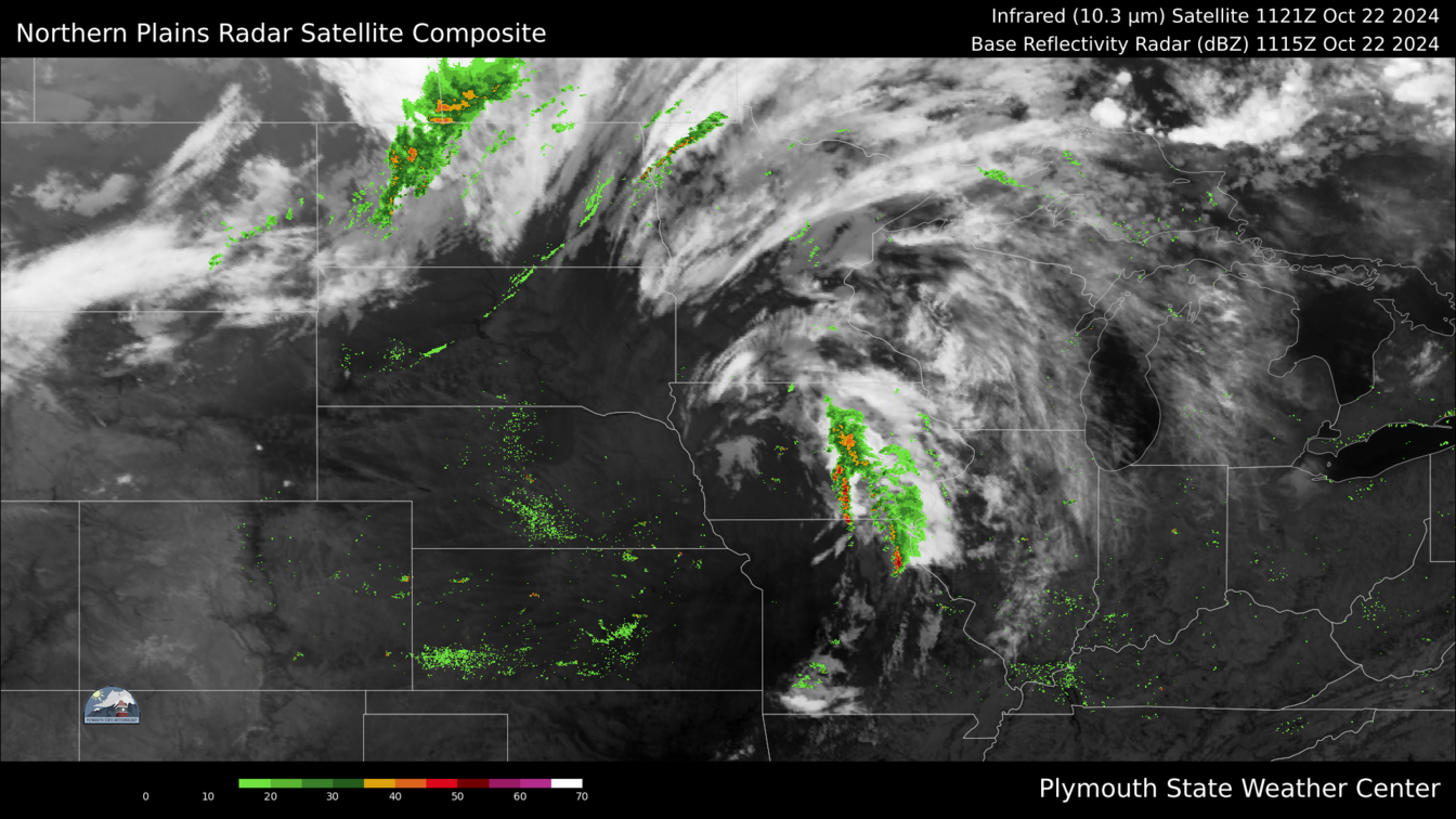
Infrared Radar

click to enlarge
click to enlarge
click to enlarge
click to enlarge
USA 1-Day Max Temp
Waupaca 2 Day Plotter
SPC Day 1 Tornado
7 Day Temps
click to enlarge
click to enlarge
click to enlarge

click to enlarge
Climatological Data
Statistical Information
Today
Yesterday
Monthly
Yearly
High Temperature
Low Temperature
25.1 at 3:17
14.8 at
7:53
25.0 at 14:12
10.2 at
0:00
27.3°F on 12/3/25
-2.0°F on
12/4/25
93.2°F on 6/22/25
-16.1°F on
1/21/25
High Humidity
Low Humidity
84 % at 0:00
71 % at
4:47
85 % at 18:42
58 % at 0:09
88 % on 12/3/25
45 % on
12/4/25
99 % on 6/27/25
23 % on
5/9/25
High Dew Point
Low Dew Point
20.3 at 1:26
9.4 at 7:38
20.4 at 21:40
-1.5 at 0:09
23.8°F on 12/3/25
-8.1°F on 12/4/25
80.7°F on 7/23/25
-23.0°F on 1/21/25
High Wind Speed
26.0mph at 2:40
24.0mph at 21:36
14.0mph on 12/3/25
29.0mph on 2/28/25
High Barometer
Low Barometer
29.03 at 20:28
28.77 at
0:26
29.08 at 0:01
28.74 at
17:24
29.48 on 12/1/25
28.74 on
12/5/25
29.67 on 2/18/25
28.02 on
3/15/25
Heating Degree Days
Cooling Degree Days
38.2 degree days
0.0 degree days
282.9 degree days
0.0 degree days
6492.0 degree days
672.5 degree days
Evapotranspiration Hi
0.01" ETo at 15:00
0.01" ETo at 15:00
0.01" ETo on 12/3/25
0.14" ETo on 5/10/25
Solar Radiation Hi
186 at 11:44
162 at 11:06
257 on 12/4/25
1209 on 5/23/25
| Temperature | Humidity | Barometer | Wind | ||||||||||||||||||||||||||||||||
20.9°F
(FEELS LIKE) 20.9°F |
81%(-4% 24hr change) |
29.03(0.28" 24hr change) |
0.0 - SSEWind Gust(26.0 mph) |
||||||||||||||||||||||||||||||||
| Temperature Chart | Dew Point-Humidity Chart | Precipitation Chart | Solar Radiation | ||||||||||||||||||||||||||||||||
|
|
|
|
|
||||||||||||||||||||||||||||||||
| Wind Chill | RH and Dew Point | Miscellaneous | Almanac | ||||||||||||||||||||||||||||||||
|
|
|
|
||||||||||||||||||||||||||||||||
| Daily Rainfall | Monthly Rainfall | Yearly Rainfall | 24 Hour Rainfall | ||||||||||||||||||||||||||||||||
|
|
|
|
||||||||||||||||||||||||||||||||
| Waupaca Fire Danger | Surface Temps | 24-Hr Temp Change | Saint Cloud Radar | ||||||||||||||||||||||||||||||||
|
|
|
|
||||||||||||||||||||||||||||||||
| Aviation Wx Center | Midwest Radar | Wisconsin Radar | Lightning Map | ||||||||||||||||||||||||||||||||
|
|
|
|
||||||||||||||||||||||||||||||||
| Day 1 Weather Map | Day 2 Weather Map | SPC Day 1 Tornado Outlook | 7-Day Precipitation (in) | ||||||||||||||||||||||||||||||||
|
|
|
|
||||||||||||||||||||||||||||||||
| GOES 16 Visible | SPC Day 2 Thunderstorms | SPC Day 1 Outlook | 24 Hr QPF Regional | ||||||||||||||||||||||||||||||||
|
|
|
|
||||||||||||||||||||||||||||||||
| Day 1 Max Temps | Day 1 Min Temps | Day 2 Max Temps | Day 2 Min Temps | ||||||||||||||||||||||||||||||||
|
|
|
|
||||||||||||||||||||||||||||||||
| Fire Wx Outlook | T-Storm Outlook | 24 hr Max Winds | Infrared Radar | |
|
|
|
||||||||||||||||||||||||||||
| USA 1-Day Max Temp | Waupaca 2 Day Plotter | SPC Day 1 Tornado | 7 Day Temps | |
|
|
Climatological Data
| Statistical Information | Today | Yesterday | Monthly | Yearly |
| High Temperature Low Temperature |
25.1 at 3:17 14.8 at 7:53 |
25.0 at 14:12 10.2 at 0:00 |
27.3°F on 12/3/25 -2.0°F on 12/4/25 |
93.2°F on 6/22/25 -16.1°F on 1/21/25 |
| High Humidity Low Humidity |
84 % at 0:00 71 % at 4:47 |
85 % at 18:42 58 % at 0:09 |
88 % on 12/3/25 45 % on 12/4/25 |
99 % on 6/27/25 23 % on 5/9/25 |
| High Dew Point Low Dew Point |
20.3 at 1:26 9.4 at 7:38 |
20.4 at 21:40 -1.5 at 0:09 |
23.8°F on 12/3/25 -8.1°F on 12/4/25 |
80.7°F on 7/23/25 -23.0°F on 1/21/25 |
| High Wind Speed | 26.0mph at 2:40 | 24.0mph at 21:36 | 14.0mph on 12/3/25 | 29.0mph on 2/28/25 |
| High Barometer Low Barometer |
29.03 at 20:28 28.77 at 0:26 |
29.08 at 0:01 28.74 at 17:24 |
29.48 on 12/1/25 28.74 on 12/5/25 |
29.67 on 2/18/25 28.02 on 3/15/25 |
| Heating Degree Days Cooling Degree Days |
38.2 degree days 0.0 degree days |
282.9 degree days 0.0 degree days |
6492.0 degree days 672.5 degree days |
|
| Evapotranspiration Hi | 0.01" ETo at 15:00 | 0.01" ETo at 15:00 | 0.01" ETo on 12/3/25 | 0.14" ETo on 5/10/25 |
| Solar Radiation Hi | 186 at 11:44 | 162 at 11:06 | 257 on 12/4/25 | 1209 on 5/23/25 |